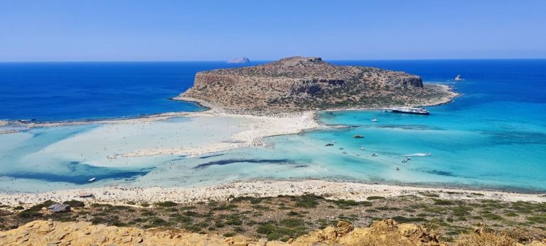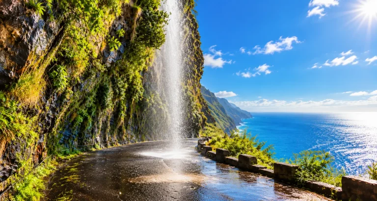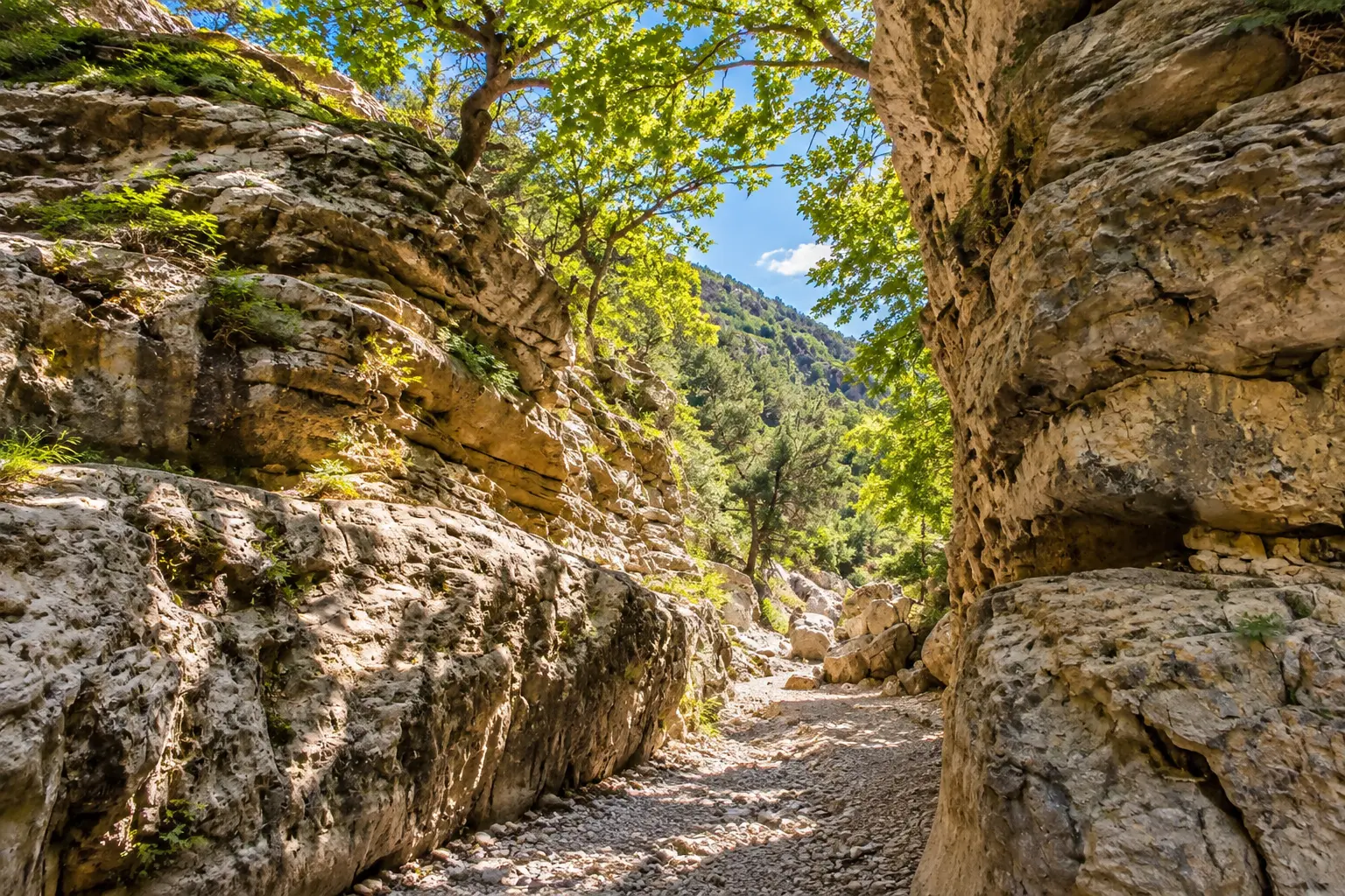
Past Vryses the road stops hugging the coast and starts climbing. Forty minutes later you are on the Askifou plateau at 740 metres, among sheep and wind and a war museum in somebody’s house. Ten kilometres further the descent begins, and that is what people come for: eleven kilometres of hairpins, seven hundred metres down, and the Libyan Sea opening all at once. The bus to Sfakia runs once or twice a day and is timed around the ferry from Agia Roumeli. Frangokastello, Ilingas and Rodakino have no bus at all.
Route at a glance
| Duration | 1 day, 11–12 hours door to door |
| Distance | ~200 km (about 125 miles), a loop |
| Driving time | 5–5.5 hours |
| Start / finish | Chania — airport (CHQ) or town centre |
| Overnight | not needed, single base |
| Furthest point | Korakas beach, Rodakino — 102 km from Chania |
| Elevation | climbs to 780 m at Imbros, then drops ~700 m in 11 km |
| Road surface | sealed the whole loop; gravel only on beach spurs and part of the Aradena approach |
| Car class | mid-range rather than the cheapest city car — you need engine braking going down and pulling power coming back |
| Driving side | right-hand side, left-hand drive cars |
| Season | year-round; May and October are best, leave before 08:00 in summer |
| Paid stops | Imbros Gorge ~€5 pp · Askifou museum ~€5 · Chora Sfakion parking ~€3/day · sunbeds €10 at Ilingas, €6–7 at Korakas · taxi Komitades → Imbros €25–30 if you walk the full gorge |
| Free | Frangokastello, Argyroupoli springs, most parking, the gorge viewpoint |
| On foot | 40 minutes (walk in to the narrows and back) to 3 hours (full gorge descent) |
| Fuel | fill up in Chania or Vryses — there is almost nothing south of there |
| Not for you if | hairpins make you anxious or carsick; the Imbros descent cannot be avoided |
Before you go: licence and insurance
An EU or UK licence is all you need. If your licence was issued in the US, Canada or Australia, Greek law also requires an International Driving Permit — a paper booklet you get at home before you travel, not something you can buy on Crete. Rental desks do not always ask for it, but the traffic police do, and an insurer can decline a claim without it. The AAA issues it in the US, the CAA in Canada, the AAA clubs in Australia.
The rest is standard: a credit card in the main driver’s name for the deposit, passport, and a licence held for at least a year. Local Cretan companies usually ask for a smaller deposit than the international chains, and many cars go out with no deposit at all.
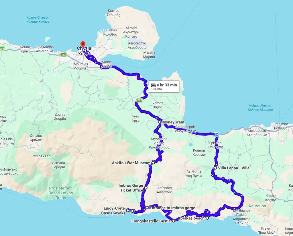
Map and legs
Open the full route in Google Maps →
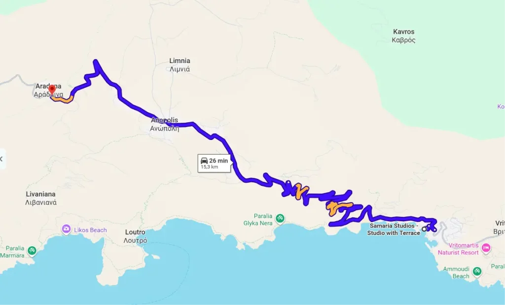
| # | Leg | Km | Time | Road | Open |
|---|---|---|---|---|---|
| 1 | Chania → Vryses | 32 | 30 min | national road, fast | → |
| 2 | Vryses → Askifou | 20 | 30 min | mountain road, climbs to 740 m | → |
| 3 | Askifou → Imbros | 7 | 10 min | flat across the plateau | → |
| 4 | Imbros → Komitades | 11 | 20 min | hairpins, ~700 m descent | → |
| 5 | Komitades → Chora Sfakion | 6 | 10 min | along the sea | → |
| 6 | Chora Sfakion → Frangokastello | 14 | 20 min | coastal, narrow | → |
| 7 | Frangokastello → Korakas | 12 | 20 min | coastal | → |
| 8 | Korakas → Argyroupoli | 28 | 40 min | climbs north through the hills | → |
| 9 | Argyroupoli → Chania via Kournas | 57 | 50 min | Episkopi, then national road | → |
| — | Optional: Chora Sfakion → Aradena | 19 | 30 min | narrow, unguarded | → |
Leg 4 is the one place on this route where the car you booked actually matters.
The loop closes along the north: from Rodakino the road climbs through Vilandredo to Argyroupoli and Episkopi, joins the national road and runs west through Vryses. You drive the Imbros hairpins once, downhill, and never have to come back up them.
Hour by hour
| Time | Stop | What you’re doing |
|---|---|---|
| 08:00 | Chania | Leave, fill up |
| 08:35–08:50 | Vryses | Coffee, last petrol station |
| 09:20–10:05 | Askifou plateau | War museum |
| 10:15–11:15 | Imbros, upper entrance | Walk in to the narrows and back |
| 11:25–11:45 | Gorge viewpoint | The view from above |
| 12:00–13:30 | Chora Sfakion | Lunch, Sfakian pie |
| 13:40–15:00 | Ilingas beach | Swim |
| 15:20–17:00 | Frangokastello | Castle and shallow water |
| 17:20–18:20 | Korakas, Rodakino | Turnaround point |
| 19:00–19:40 | Argyroupoli | Springs, coffee |
| 20:30 | Chania | Back |
Walking the full gorge instead: enter at 10:15, out at Komitades around 13:00, taxi back up to the car, Chora Sfakion by 14:00. Ilingas and Rodakino drop out of the day.
Why you need a car
Crete’s public transport is KTEL, the intercity bus network. It covers the north coast well — Chania to Rethymno to Heraklion, hourly, a few euros. The south is another matter. The bus into Chora Sfakion arrives to meet the ferry and leaves again in the evening, so your day is built around a boat from Agia Roumeli rather than around you. Frangokastello is simply not in the system: it is fourteen kilometres along the coast with no service of any kind. The same goes for Rodakino, Ilingas and Aradena.
With a car the day works differently. Out of Chania at eight, on the plateau by ten, in Chora Sfakion by one for Sfakian pie and honey, two hours on the sand below the castle, back in the dark through Argyroupoli. Five hours of driving and not one minute of waiting.
The stops
Chania Old Port
start, 08:00
Worth basing yourself here: the Venetian harbour, narrow lanes, the car parked at the hotel and ten minutes to the main road. Leaving at eight avoids both the heat on the plateau and the convoy of tour coaches that hits the descent from about nine.
- Parking in the old town is paid and tight — book somewhere with a space.
- Fill up here. Between Vryses and Chora Sfakion there is almost nothing.
Vryses
32 km, 30 min · 15 min stop
The junction where the real driving starts: national road before it, mountain road after. The village is known for its plane trees over the river and cafés serving local yoghurt with honey — the last proper stop before the climb.
- Last petrol station before the mountains.
- The yoghurt and honey is a genuine local thing, not a tourist invention.
Askifou plateau and the war museum
20 km, 30 min · 45 min stop
A flat bowl at 740 metres ringed by the White Mountains: fields, sheep, wind even in July. The stop here is the Hatzidakis family’s private war museum in Ammoudari — several rooms packed to the ceiling with material recovered from the 1941 Battle of Crete. In May of that year Allied troops retreated across this plateau on their way to the coast, and the collection is essentially what the family picked up afterwards. The owner shows you round himself and pours raki, so twenty minutes becomes an hour.
- Around €5, open daily roughly 08:00–20:00.
- The main collection is upstairs and the stairs are steep.
- Free parking along the road.
Imbros, upper gorge entrance
7 km, 10 min · 40 min to 4 hours
The decision point of the day. The gorge is walked downhill only, and your car stays here: eight kilometres of trail, six hundred metres of descent, two and a half to three hours, and what waits at the bottom is not your car but a taxi. If your day is about the driving, walk in from the ticket office for a kilometre or so to the first narrows, where the walls close to about a metre and a half, then turn back. An hour in total, and much the same feeling.
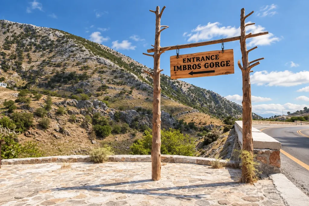
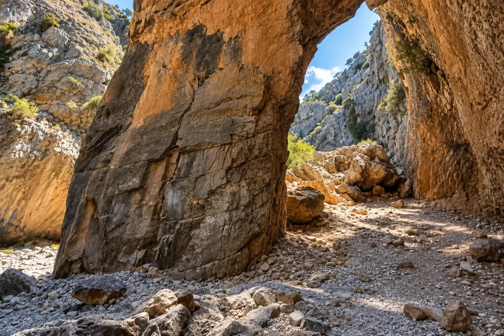
- The real ticket office is at the far end of the village. The “entrance” and “free parking” signs on the approach are put up by tavernas.
- Around €5, keep the ticket — it is checked at the bottom.
- Stiff soles: the trail runs down the riverbed and the stones move.
Gorge viewpoint
4 km, 7 min · 20 min stop
A café built on the edge, roughly halfway down. From here the whole gorge is visible from above, right down to where it meets the sea — the one spot where the scale of it makes sense. Fresh juice, Sfakian pies, a tame goat in the yard.
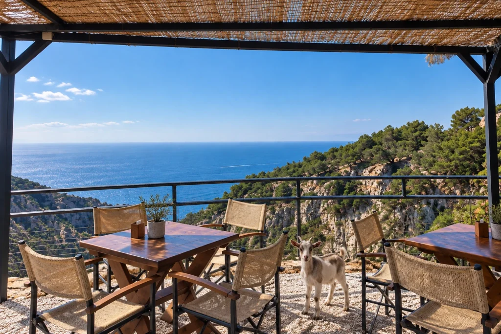
- The turn-off is short and sharp, and the sign comes up late.
- Tables sit at the edge with nothing between them and the drop.
Komitades, lower entrance
7 km, 13 min · drive-through
Where the gorge lets out, and where the taxis wait. If you walked the whole thing, this is where you come out and where you start the trip back up to your car. If you didn’t, the village is still worth driving through for the view of the Libyan Sea that opens after the last bend.
- Taxi back to the upper entrance: about 20 minutes, €25–30 per car, less if you share.
- Some of the parking belongs to tavernas and is “free” if you order.
Chora Sfakion
6 km, 10 min · lunch, 1.5 hours
Two hundred residents, a harbour, one row of tavernas and ferries to Loutro and Agia Roumeli — villages with no road to them at all. This was the end point of the Allied retreat in May 1941: around ten thousand troops were taken off the beach here over four nights, and several thousand more were left behind when the ships stopped coming. There is a memorial above the harbour. Sfakia spent centuries apart from the rest of Crete and it still shows — nobody smiles automatically or waves you into a restaurant. Lunch is Sfakian pie, a thin pan-fried round of soft cheese finished with honey.
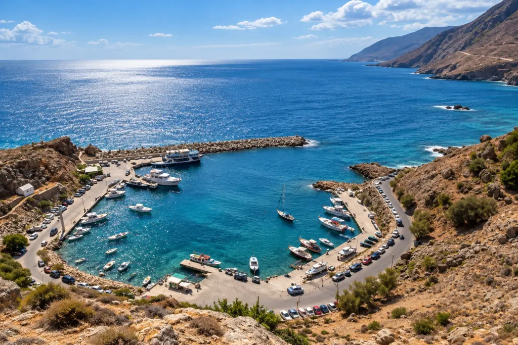
- Harbour parking is about €3 a day; the free spaces on the descent road are gone by 11:00.
- Busiest around 17:00, when the Agia Roumeli ferry lands.
- One cash machine, and it runs empty.
Ilingas beach
2 km, 5 min · 1–2 hours
A shingle cove between cliffs, water clear to the bottom, the walls sheltering it from the north wind. On days when the whole north coast is being blown sideways, it is flat calm here. Sunbeds are paid, the water is free, and there are rocks at either end to jump off.
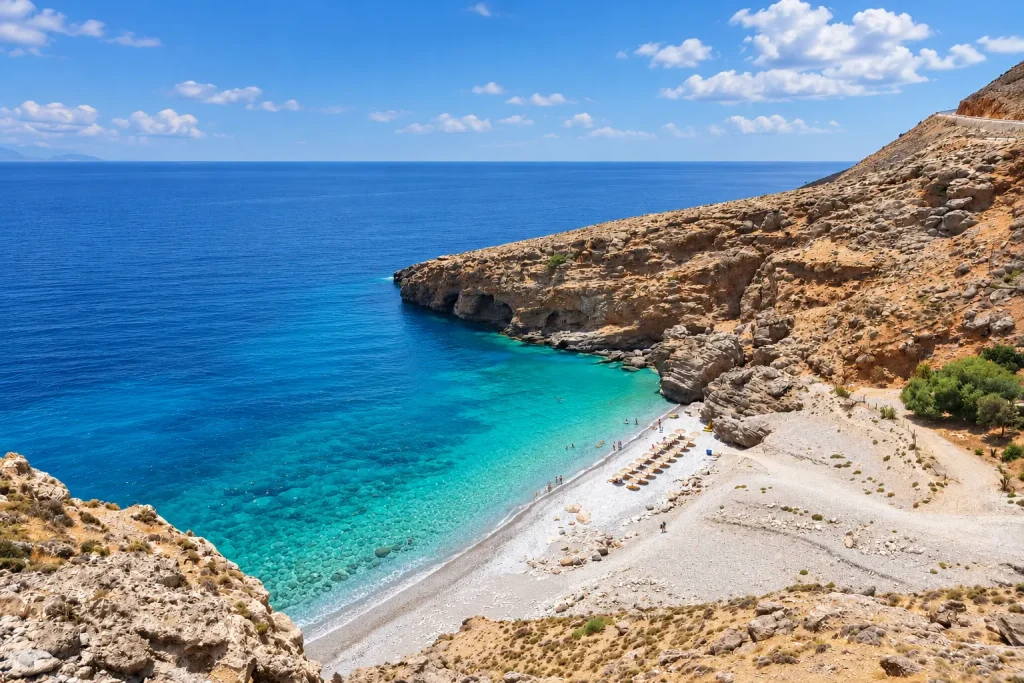
- About ten parking spaces, gone by midday.
- Sunbeds from €10 a pair, more for the front row.
- Five minutes down past the taverna to the water.
Aradena bridge (optional, +1 hour)
19 km, 30 min
A steel bridge over a hundred-metre gorge leading to an abandoned village, with a bungee platform on it. The road up through Anopoli is narrow sealed surface with no barriers, broken in places, and usually a herd of goats standing in it. The landscape up there is empty enough that an oncoming car counts as an event.
- Not for everyone: if the Imbros hairpins were hard work, skip this.
- You can drive across — the deck is timber planking.
- Check what your rental agreement says about unsealed roads.
Frangokastello
14 km, 20 min · 2 hours with a swim
A Venetian castle from 1371 standing directly on the sand, no fence and no ticket desk. Inside is an empty courtyard; outside is the gentlest entry to the sea on the whole south coast, shallow and warm for thirty metres — the best beach on this route if you have children. The local story about the drosoulites, the shapes of dead warriors appearing at dawn in late May, is one people tell you seriously.
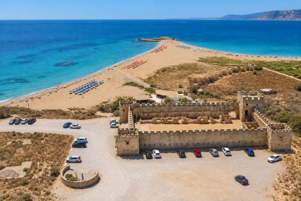
- Free entry, closed Tuesdays, roughly 10:00–18:00.
- Free parking by the road.
- No shade in the towers — bring an umbrella.
Korakas beach, Rodakino
12 km, 20 min · turnaround
Sand, clear water, three tavernas and almost nobody even in August, because the only people who get here are the ones who meant to. This is where you turn north. It is an exposed stretch, so in strong wind there is real surf.
- Sunbeds €6–7 a pair, and there aren’t many.
- Parking right at the beach, limited.
Argyroupoli
28 km, 40 min · 40 min stop
The climb off the coast delivers you to a village built on ancient Lappa, where springs come straight out of the rock and the water runs under the taverna tables. Plane trees, old mill wheels, and a drop in temperature that makes it feel like a different island after the southern glare. Too late for lunch by now, but exactly right for coffee before the last hour of road.
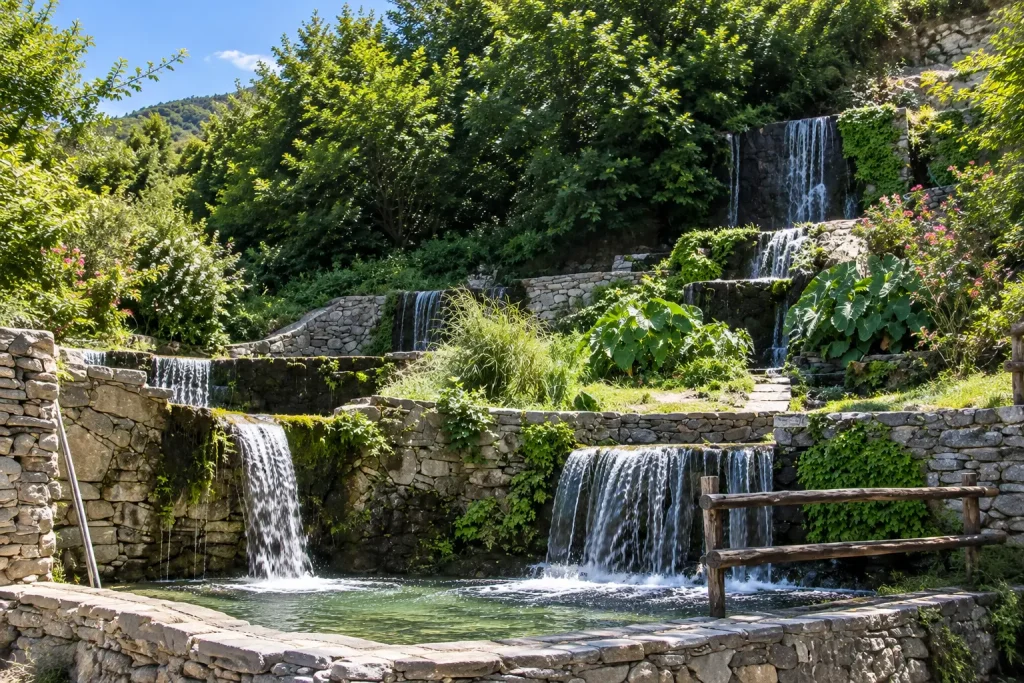
- Springs are in the lower village, the archaeology and the Byzantine church in the upper.
- Free parking, but tight — get there before 18:00.
- The trout in the tavernas comes from these springs.
Lake Kournas (detour, +20 min)
27 km, 25 min
Crete’s only freshwater lake, five kilometres off the national road. Pedal boats, terrapins in the reeds, a ring of souvenir stalls. Frankly touristy, but if there is still light after Argyroupoli it makes an easy last stop.
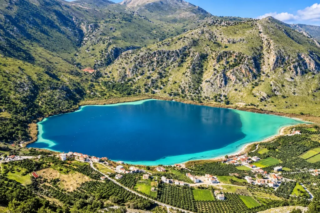
- Parking about €3, free spaces further up the road.
- Pedal boat around €15 an hour.
- The terrapins stay along the far shore.
Renting for this route
| Class | mid-range (Polo, Corsa, Clio) rather than a 1.0 city car |
| Transmission | automatics are fine here — but book early and avoid the smallest engine |
| Going downhill | use L, B or the manual/paddle mode rather than riding the brakes |
| Ground clearance | standard is fine, you do not need an SUV |
| Air conditioning | essential — the plateau touches 40 °C in summer |
| Insurance | full cover with no excess: the roads are narrow and scrapes against rock are routine |
| Deposit | local Cretan companies ask for less, or nothing |
| Check in the contract | the unsealed-roads clause — beach spurs and the Aradena approach fall under it |
| Where to collect | Chania airport or town; the route is a loop and ends where it starts |
The eleven kilometres from Imbros down to Komitades are the most spectacular road in western Crete and the only stretch where the booking decision shows up. If you hold the brakes the whole way down, the pedal will go soft before the bottom, and that is not a figure of speech — drop into a low gear and let the engine do the work. Almost every automatic on the island has an L or B position or a manual mode for exactly this.
Which is also why the cheapest line in the search results, a 1.0-litre automatic, is the worst car for this day: it holds no speed back going down and struggles coming up with four people and the air conditioning running. The next class up costs three or four euros a day more and earns it here.
Automatics are a small share of the Cretan fleet and they sell out first in July and August. If you cannot drive a manual, book weeks ahead rather than days.
When to go
| Season | What it’s like |
|---|---|
| May–June | The best of it: green, the sea already warm, the descent empty |
| July–August | 40 °C on the plateau, coach convoys on the hairpins, full beaches. Leaving before 08:00 is not optional |
| September–October | Second window: warmest sea of the year, half the crowds |
| November–April | Sfakia stays mild and Imbros stays open, unlike Samaria. Tavernas open selectively, ferries on reduced timetables |
FAQ
About 75 km and an hour and a half. It looks shorter on the map, but the last 11 km are a descent of 700 metres and there is no way to do it faster.
The gorge is walked downhill, so your car stays at the upper entrance. Taxis wait at Komitades at the bottom: about 20 minutes back up, €25-30 per car. The alternative is to walk in from the top as far as the narrows and return on foot.
Not with an EU or UK licence. US, Canadian and Australian licences do require one under Greek law, and you have to arrange it at home before you travel.
Not the way you came. From Rodakino the road climbs north through Vilandredo to Argyroupoli and Episkopi, joins the national road and runs west through Vryses. That makes the day a loop and means you drive the Imbros hairpins only once.
No, as long as it is not the smallest engine and you use the L or manual mode on the descent instead of the brakes. Book early — automatics are a small part of the fleet on Crete.
The main loop is sealed throughout. Beach spurs and part of the Aradena approach are not, and most rental agreements exclude them — worth checking when you book.
The harbour car park is about €3 a day. There are free spaces along the descent road, but they fill by 11:00 with the ferry traffic.
No, they are at opposite ends of western Crete. Sfakia is a day of its own, and Balos and Elafonissi are separate trips from the same base in Chania.