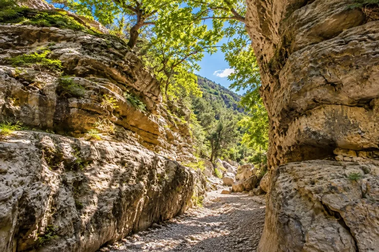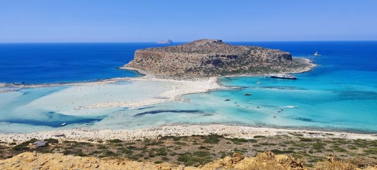
In short: the perfect 3-day Madeira itinerary by rental car — about 260 km, three completely different landscapes (cliffs and banana plantations, peaks above the clouds, a “lunar” cape at the eastern tip), a ready-made day-by-day schedule with mileage, driving times and the best hours for every stop.
Madeira feels like an island designed for road trips. It’s compact (just 57 km west to east) yet incredibly dense with impressions: in half an hour of driving you climb from sea level to 1,800 metres, swap palm trees for fern forest and fog for blinding sunshine. Public transport exists but is tied to Funchal and the main towns: no bus will get you to the viewpoints, the old-road tunnels or the best sunrise spots. So the classic way to see the island is to rent a car and loop around it.
Below is a tried-and-tested three-day route for first-time visitors. It collects the island’s “postcard sights” — the glass Cabo Girão skywalk, the summit of Pico do Arieiro, the thatched houses of Santana and the wild Ponta de São Lourenço — without turning your holiday into a rally: every day leaves time for coffee, the ocean and an unhurried levada walk.
Route at a Glance
| Duration | 3 days, 3 nights |
| Mileage | ~250–270 km total |
| Time behind the wheel | 6.5–7 hours for the trip (1.5–3 hours per day) |
| Start | Funchal (FNC airport or city centre) |
| Finish | Funchal Airport (FNC) — drop the car before your flight |
| Overnight base | Funchal all three nights (option: last night in Santa Cruz by the airport) |
| Highest point | Pico do Arieiro, 1,818 m — tarmac right to the viewpoint |
| Elevation gain | 0 → 1,818 m over ~30 km of climbing from Funchal |
| Road surface | tarmac throughout: VR expressways in tunnels + old ER mountain roads |
| Recommended car class | compact or mid-size, engine from 1.2 turbo / 1.6 — you want reserve power on climbs |
| Season | year-round; best in April–June and September–October |
| Paid sights | PR levada trails — €3 per person (online via SIMplifica) · parking in Funchal and Câmara de Lobos €1–2/hour |
| Free | Cabo Girão Skywalk, all miradouro viewpoints, Anjos waterfall, Ponta de São Lourenço, Santana houses (from outside) |
| Walking sections | Balcões levada PR11 — 1–1.5 h · São Lourenço PR8 — from 40 min to 3 h |
| Fuel | fill up in Funchal and coastal towns: there are no petrol stations in the mountains |
| Not for | severe fear of heights (clifftop viewpoints); if you get carsick, the old switchbacks can be swapped for tunnels |
What to Know Before You Start
Which car to rent. A compact is enough for this route, but there’s a nuance: Madeira is a mountainous island and some climbs are seriously steep. Two people with carry-ons — a small engine will do. A party of 3–4 with luggage — take at least a 1.2 turbo or a 1.6 naturally aspirated engine: on a fully loaded switchback a weak motor will struggle. Gearbox is up to you, but an automatic makes life much easier on uphill traffic lights.
Roads. The main corridors are linked by expressways (Via Rápida) with dozens of tunnels — you can cross the island from Funchal in under an hour. Parallel to them run the old roads (ER101 and regional ones) — narrow and twisty, and they are the attraction in themselves. Route strategy: “business” transfers through tunnels, scenic stretches on the old roads.
Tolls and fines. There are no toll roads on Madeira. Speeding fines are real: cameras sit inside tunnels too. The limit in built-up areas is 50 km/h; on the VR1 expressway it’s 80–100 km/h depending on the section, in tunnels usually 80. Follow the signs.
Weather and microclimates. The island rule: if it’s raining in Funchal, drive north or into the mountains — it may well be sunny there, and vice versa. Before heading up to the peaks, check the webcams (on turismodamadeira and windmadeira) — it saves an hour of climbing “into milk”.
How much to plan per day. This route means 60–100 km per day, 1.5–3 hours of pure driving and 4–6 stops. A comfortable pace with room for “stop, it’s beautiful here” — and there will be many such places.
Need a car for this route?
On Carenzzo you can compare offers from local rental companies and international brands and book online: pick-up at the Funchal Airport terminal, CDW insurance already included, and many companies offer zero-deposit deals and free cancellation. Mini class from €13/day in low season, a compact in summer — €45–60/day.
Day 1. Southwest: Cliffs, Bananas and Winston Churchill’s Fishing Village
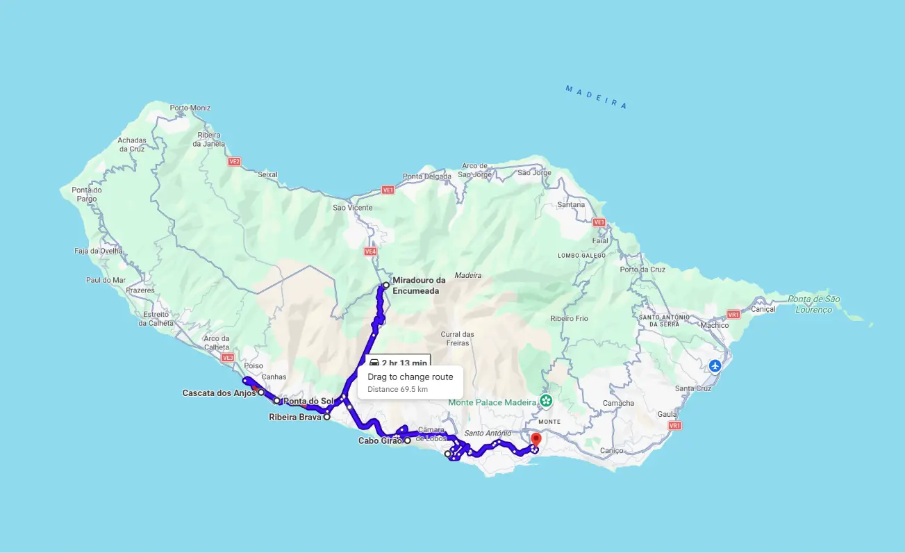
Day total: ~90 km · 2 hours of driving · 6 stops
Legs of the day:
| № | Leg | Km | Time | Character |
|---|---|---|---|---|
| 1 | Funchal → Cabo Girão | 13 | 20 min | VR1 expressway through tunnels |
| 2 | Cabo Girão → Câmara de Lobos | 7 | 15 min | switchback descent to the harbour |
| 3 | Câmara de Lobos → Ribeira Brava | 10 | 15 min | VR1 |
| 4 | Ribeira Brava → Encumeada → Ribeira Brava | 24 | 45 min | climb to the pass and back the same way |
| 5 | Ribeira Brava → Ponta do Sol | 8 | 12 min | VR1 along the coast |
| 6 | Ponta do Sol → Anjos waterfall | 4 | 8 min | old coastal ER101, narrow |
| 7 | Anjos → Funchal | 27 | 30 min | VR1 through tunnels |
Hour-by-hour:
| Time | Place | What we do |
|---|---|---|
| 9:00 | Funchal | Depart west on the VR1 |
| 9:20–10:10 | Cabo Girão | Skywalk over the 580-metre cliff |
| 10:25–11:50 | Câmara de Lobos | Harbour, poncha, Churchill viewpoint |
| 12:05–12:35 | Ribeira Brava | Market, mini-bananas for the road |
| 12:50–13:35 | Encumeada | Climb to the pass, panorama, back to Ribeira Brava |
| 13:50–15:15 | Ponta do Sol | Lunch by the ocean in the island’s sunniest spot |
| 15:25–16:15 | Anjos waterfall | Old ER101, “driving through the waterfall” |
| 17:00 | Funchal | Return, dinner in the old town |
9:00 — Start from Funchal
Leave the capital heading west on the VR1 expressway. If you’re not flying out on arrival day and haven’t seen Funchal yet, it makes sense to give it the evening before: the Lavradores market, the cable car to Monte, the old town with painted doors on Rua de Santa Maria. In this route, the capital is your overnight base.
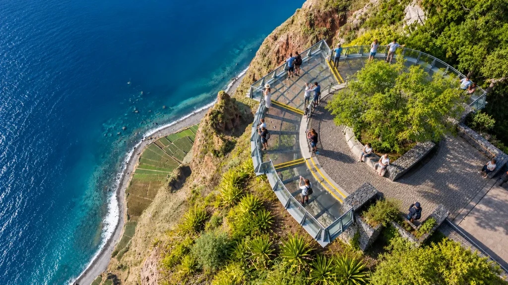
9:40 — Cabo Girão: A Viewpoint Above a 580-Metre Cliff
The first stop of the day is one of the highest sea cliffs in Europe. At its edge sits the Skywalk viewing platform with a transparent glass floor: beneath your feet — almost 600 metres of air and tiny vegetable terraces at the bottom. Mornings bring fewer people and soft light for photos.
- Time needed: 30–40 minutes
- Cost: free entry, free parking (at the top, 3 minutes on foot)
- Tip: if heights bother you, don’t look down right away — approach the edge “in stages”. The glass is scratched, but the transparency still thrills.
10:30 — Câmara de Lobos: Harbour, Poncha and Churchill
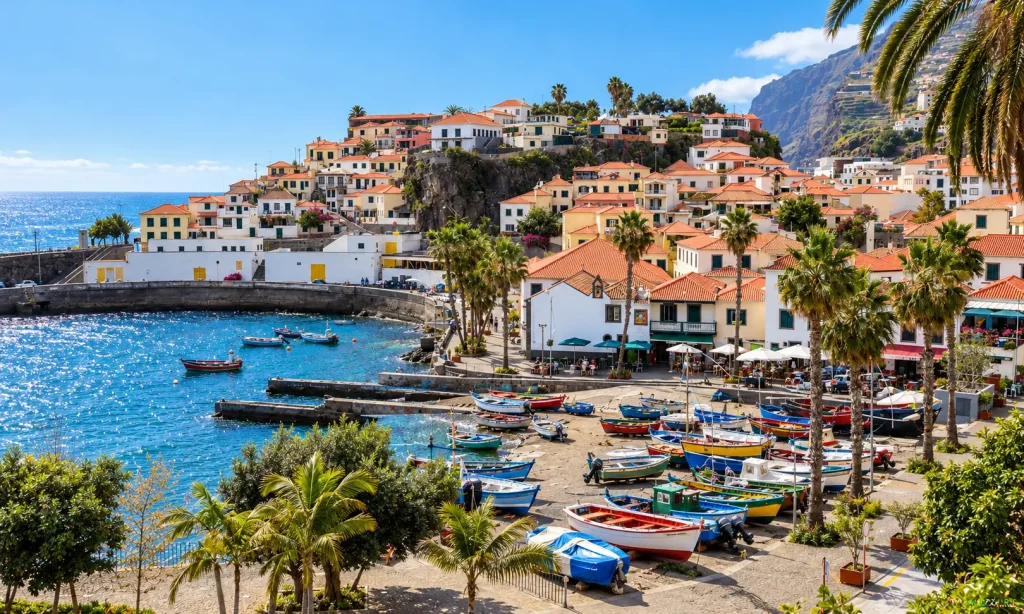
Descend to the coast, to the fishing village Winston Churchill painted at his easel in 1950 — a viewpoint here is named after him. Câmara de Lobos means brightly painted boats, the catch of black scabbardfish (espada) and the island’s best concentration of bars serving poncha — Madeira’s signature drink made from aguardente (sugarcane spirit), honey and lemon.
- Time needed: 1–1.5 hours with coffee or lunch
- Parking: paid car park by the harbour, ~€1/hour
- Don’t miss: the promenade and the Miradouro Winston Churchill — the harbour from above, the classic shot.
12:30 — Ribeira Brava and the Banana Valley
Continue west. Ribeira Brava (“wild river”) is a pleasant little town with a black-pebble beach and one of the island’s oldest churches (15th century). A good place for a quick coffee stop before the climb into the mountains.
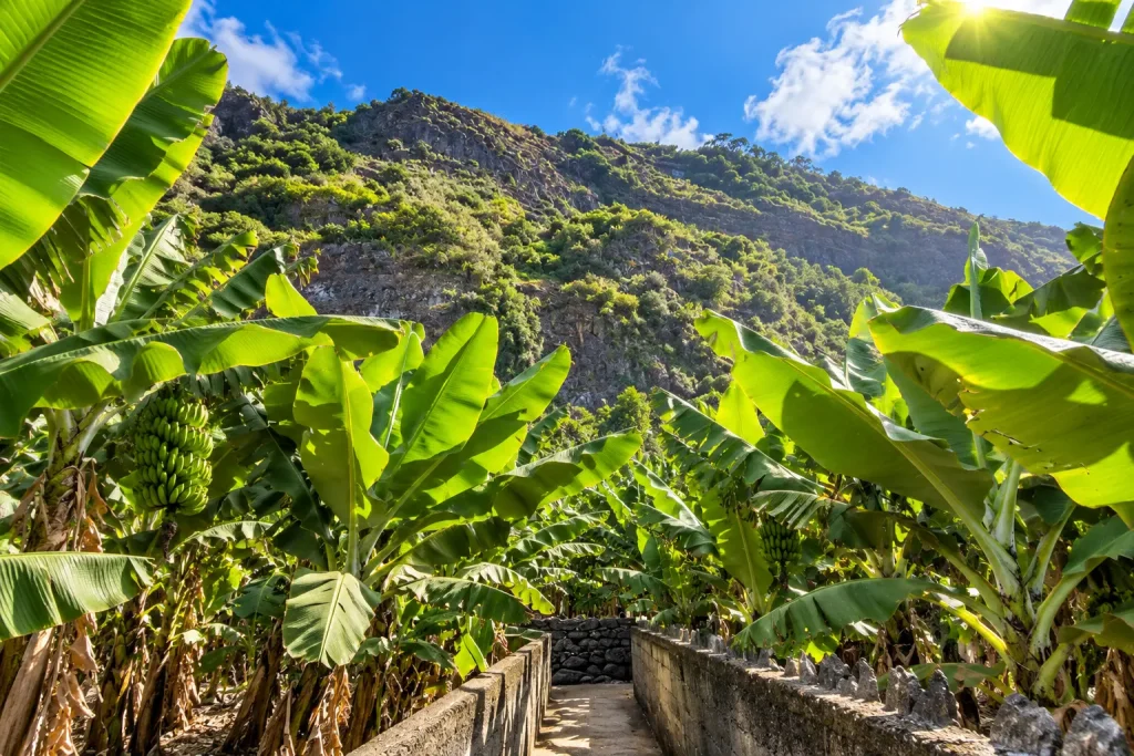
The bananas start just beyond. Terraces of banana plantations tumble towards the ocean all along the south coast. The densest, most scenic stretch is the old ER101 between Ponta do Sol and Madalena do Mar — the road you’ll take to the Anjos waterfall. Madeira is famous for its mini-bananas: small, sweet, with a hint of acidity. Buy them at roadside stalls and supermarkets along the way, or at the Lavradores market in Funchal.
12:50 — Encumeada and Ponta do Sol
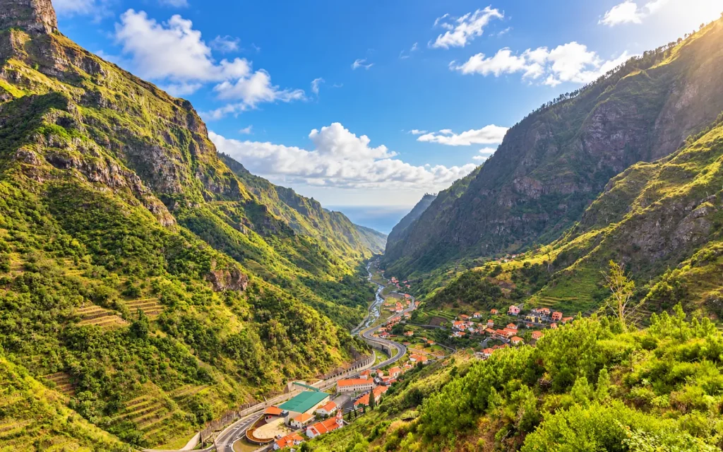
From Ribeira Brava the ER228 climbs steeply into the mountains towards the Encumeada pass (1,007 m) — from the viewpoint at the top you get the day’s best panorama: the “heart” of the island, valleys and the jagged teeth of the central massif. An important nuance: there’s no through road to Ponta do Sol from here — beyond the pass the road descends to the north coast, to São Vicente. So take in the panorama and descend the same road back to Ribeira Brava (the round trip is 24 km and about 45 minutes behind the wheel — worth it), then continue along the coast to Ponta do Sol, considered the sunniest place on the island. A small quayside promenade, palm trees, cafés by the water — a good spot for lunch with an ocean view.
15:30 — Anjos Waterfall (Cascata dos Anjos)
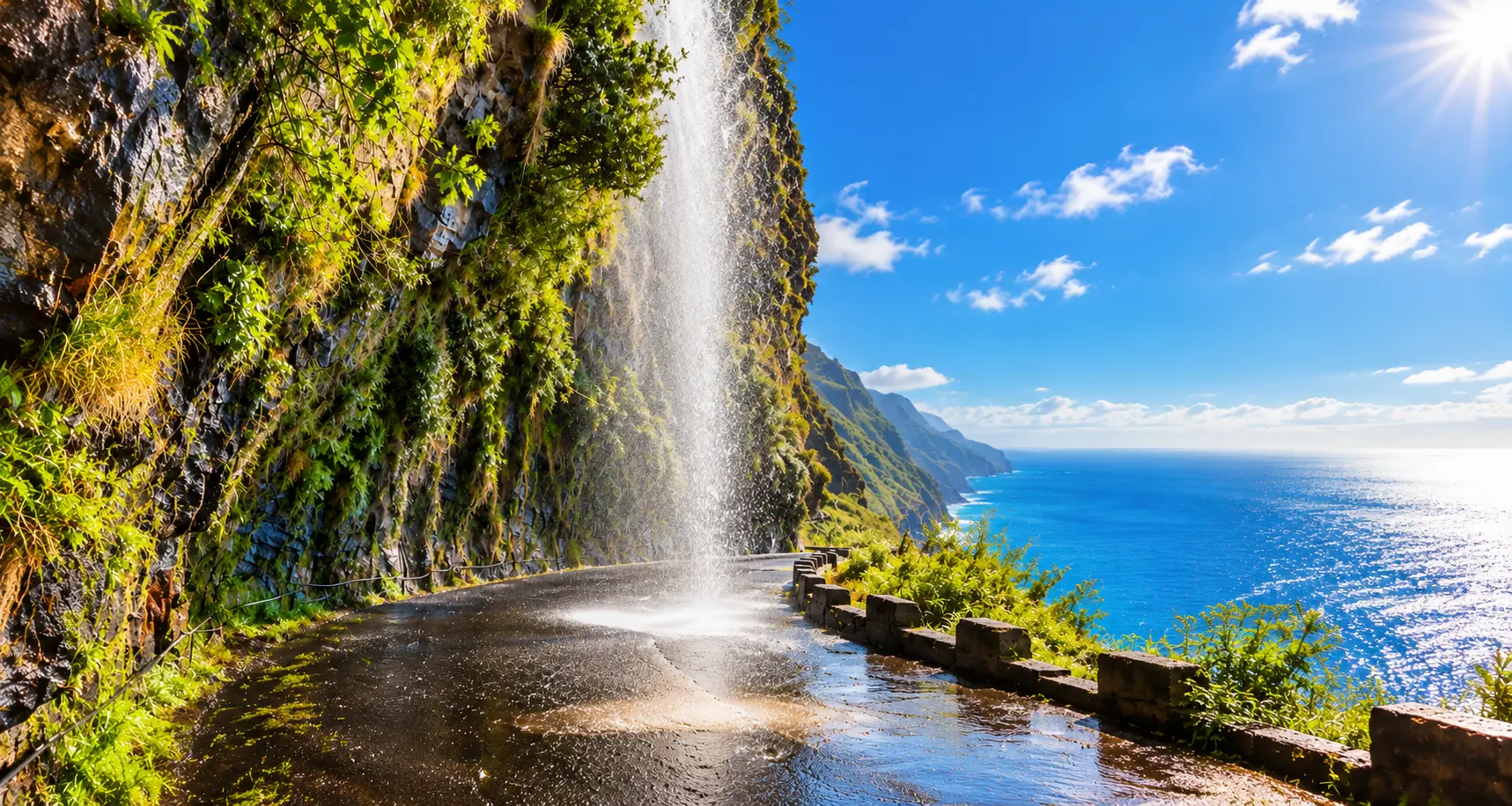
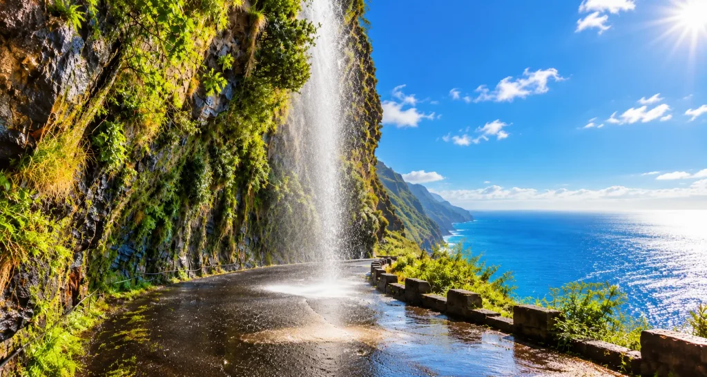
From Ponta do Sol drive a couple more kilometres west — not through the tunnel but along the old ER101 road — the most atmospheric stretch of the day. The Anjos waterfall drops straight onto the road, and once actually across it: cars literally drive through the spray. Pull into the lay-by: the “waterfall + road + ocean” frame is one of Madeira’s most viral shots.
- Important: this section of the old road is sometimes closed after heavy rain because of rockfalls — check locally; there’s always the tunnel as an alternative.
17:00 — Return to Funchal
Back to the capital by evening. Dinner recommendation: the old town (Zona Velha), Rua de Santa Maria and the lanes around it — dozens of taverns with grilled espada, tuna with fried cornmeal (milho frito) and Madeira wine by the glass.
Day 2. Mountains and the Northeast: Sunrise Above the Clouds, Santana’s Houses and Laurel Forest
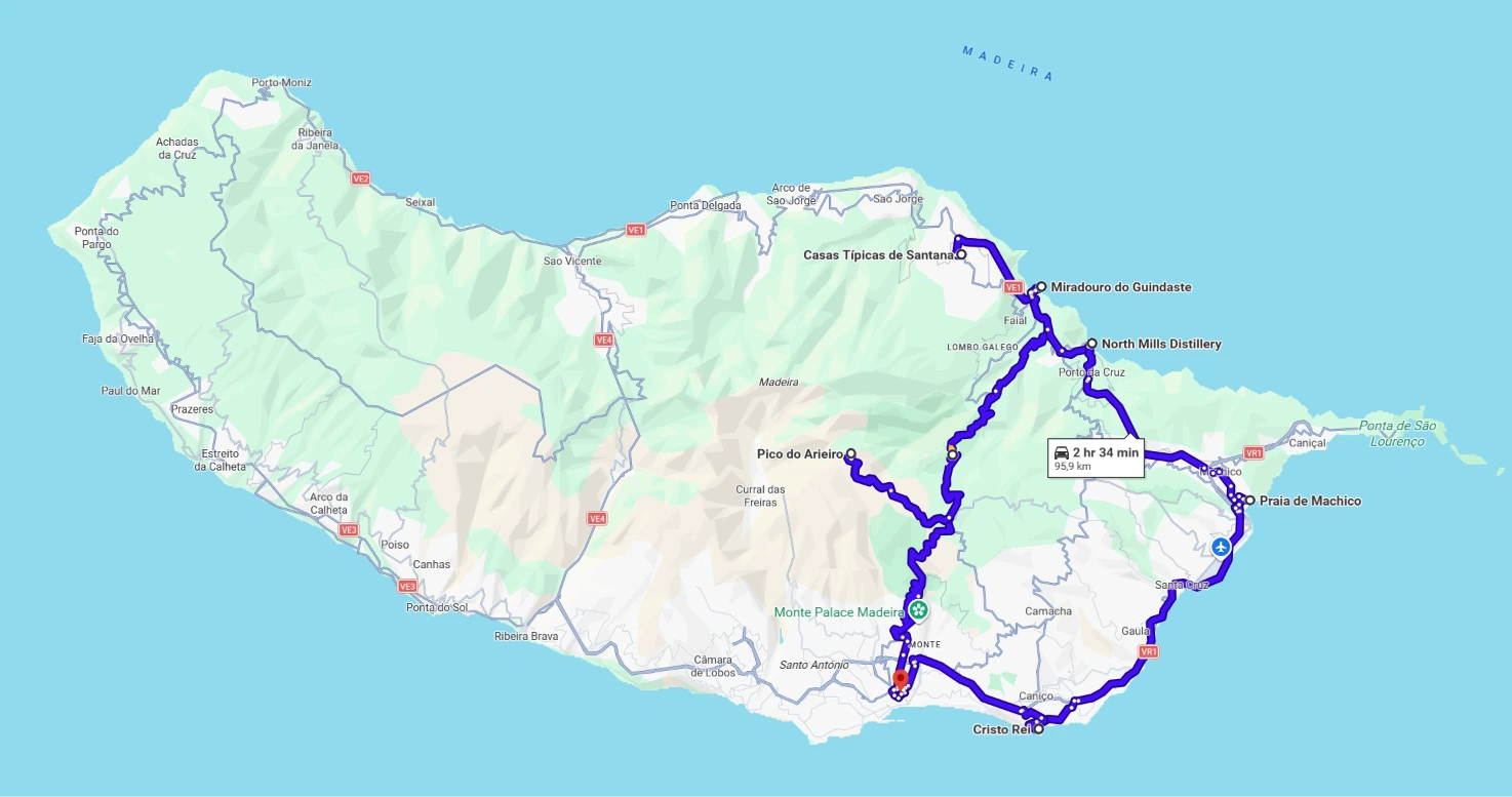
Day total: ~100 km · 2.5–3 hours of driving · 6 stops
Legs of the day:
| № | Leg | Km | Time | Character |
|---|---|---|---|---|
| 1 | Funchal → Pico do Arieiro | 20 | 35 min | steep mountain climb to 1,818 m |
| 2 | Arieiro → Ribeiro Frio | 10 | 15 min | descent through conifer forest |
| 3 | Ribeiro Frio → Santana | 15 | 25 min | mountain switchbacks |
| 4 | Santana → Faial | 9 | 15 min | descent to the north coast |
| 5 | Faial → Porto da Cruz → Machico | 19 | 30 min | coastal road |
| 6 | Machico → Caniço → Funchal | 28 | 35 min | VR1 through tunnels |
Hour-by-hour:
| Time | Place | What we do |
|---|---|---|
| 6:15* | Funchal | Depart (50 min before sunrise) |
| 6:35–7:45 | Pico do Arieiro | Sunrise above the sea of clouds |
| 8:30–10:00 | Ribeiro Frio | PR11 levada to the Balcões viewpoint |
| 10:45–11:30 | Santana | The triangular houses |
| 11:45–13:15 | Santana or Faial | Lunch: espetada on a bay skewer |
| 13:30–14:30 | Faial | Eagle Rock view, beach |
| 15:00–16:00 | Porto da Cruz | The 1927 rum distillery |
| 16:15–17:15 | Machico | Promenade, sandy beach |
| 18:00–18:45 | Caniço / Garajau | Christ statue, sunset over the south coast |
| 19:15 | Funchal | Return |
* Times are given for June. Sunrise in Madeira ranges from ~7:05 in summer to ~8:15 in mid-October, so check it for your date and shift the whole day’s schedule by the same difference.
Sunrise — Pico do Arieiro: Greeting the Sun at 1,818 Metres
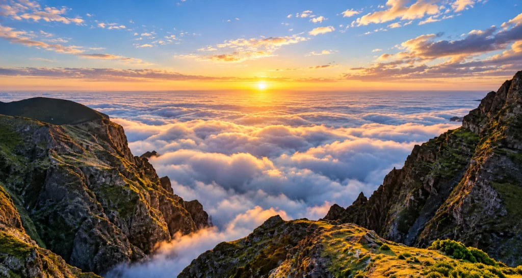
The earliest and most impressive morning of the trip. Pico do Arieiro is the island’s third-highest peak, and a tarmac road leads right to the viewpoint. The trick: thanks to temperature inversion, clouds often “hang” below the summit, and you stand above a white sea of clouds with mountain peaks poking through.
- Departure from Funchal: 50 minutes before sunrise (the climb takes ~35 minutes plus time to find a parking spot). In summer that’s about 6:15, in autumn about 7:20.
- Clothing: it’s 10–15 °C colder up top than at the ocean, plus wind. A jacket is a must even in summer
- Parking: free, right by the viewpoint
8:30 — Balcões Levada (PR11, Vereda dos Balcões)
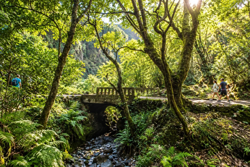
Drop a little lower to the village of Ribeiro Frio — the start of the island’s most accessible and rewarding levada. Levadas are Madeira’s unique network of irrigation channels, over 2,000 km in total, with walking paths alongside; many run through the relict Laurisilva laurel forest, a UNESCO World Heritage site. The walk to the Balcões viewpoint takes 30–40 minutes each way along a flat trail through fern forest — the finale is a balcony above a green valley with the teeth of the central massif beyond.
- Difficulty: easy, suitable for everyone including children
- Time: 1–1.5 hours round trip with photos
11:00 — Santana: The Famous Triangular Houses
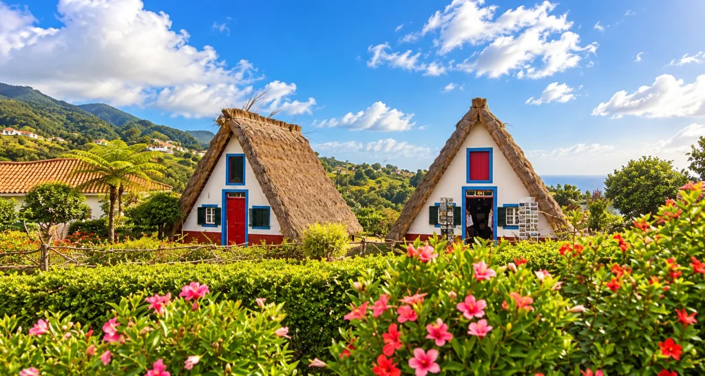
Drive northeast to the town of Santana and its trademark — the traditional palheiros houses: triangular, with thatched roofs reaching the ground and brightly painted façades. Farmers once lived in them; today several houses survive as a museum and tourist complex. It’s a “for the photo” stop — no need to linger, but you can’t skip it: these houses are on every Madeira postcard.
12:30 — Lunch in Santana or Faial
Santana has several decent home-style restaurants: try the espetada — beef skewered on a bay-laurel stick, served hanging from a stand. The alternative: drive 10 minutes to Faial and have lunch by the ocean.
14:00 — Faial and the Guindaste Viewpoint
Faial is a green village at the foot of the cliffs. Two reasons to stop: the viewpoint overlooking “Eagle Rock” (Penha d’Águia) — a 590-metre crag jutting into the ocean — and a small pebble beach with a pool if the weather invites a swim.
15:30 — Porto da Cruz and Machico
Descend to the southeast coast. Porto da Cruz is a quiet port in the shadow of the same Eagle Rock, home to the Engenhos do Norte rum distillery (working since 1927; in spring — steam engines and fresh sugarcane juice). Fifteen minutes further is Machico, the island’s second town and the place where Madeira’s discoverers landed in 1419. There’s a lovely promenade and a sandy beach rare for the island (the sand is imported from Morocco).
17:30 — Return to Funchal via Caniço
The way back is 40 minutes on the expressway. If you have energy left, take a 5-minute detour off the motorway: Caniço and its viewpoint above the rocky south shore, and next to it the village of Garajau with a huge statue of Christ (a mini version of Rio’s) and one of the best sunsets in the south.
Day 3. The East: The “Lunar” Cape of São Lourenço and Farewell to the Island
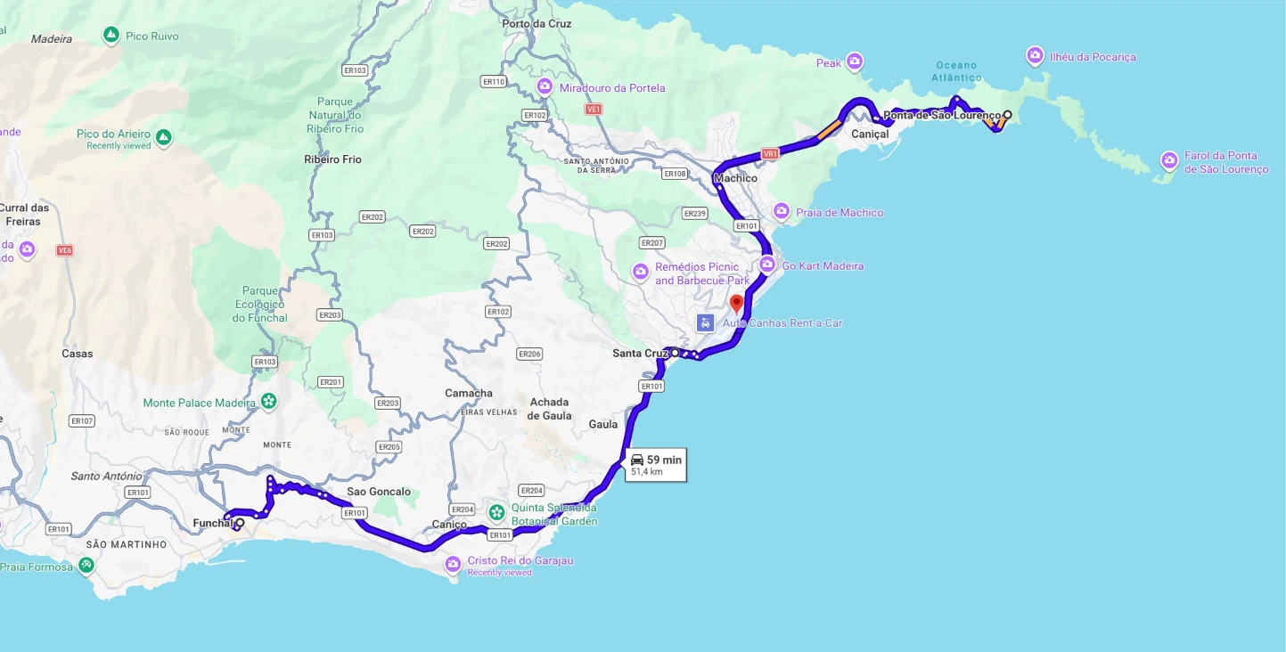
Day total: ~60 km · 1–1.5 hours of driving · 3–4 stops
This day pairs nicely with your departure: every stop is close to Funchal Airport (also known as Cristiano Ronaldo Airport), so the route runs “east to the cape → back to the terminal”.
Legs of the day:
| № | Leg | Km | Time | Character |
|---|---|---|---|---|
| 1 | Funchal → Ponta de São Lourenço | 30 | 40 min | VR1, then a mountain road to the cape |
| 2 | PR8 trail along the cape | — | 40 min – 3 h | on foot, 3 km each way along the ridge |
| 3 | São Lourenço → Santa Cruz | 22 | 30 min | back on the VR1 |
| 4 | Santa Cruz → FNC airport | 4 | 7 min | urban |
Hour-by-hour:
| Time | Place | What we do |
|---|---|---|
| 8:30 | Funchal | Depart east |
| 9:15–12:30 | Ponta de São Lourenço | PR8 hike along the “lunar” ridge |
| 13:00–14:30 | Santa Cruz | Lunch on the promenade, planes over the ocean |
| 15:00 | FNC Airport | Refuel 2 km from the terminal, drop off the car |
9:00 — Ponta de São Lourenço: The Edge of the Earth
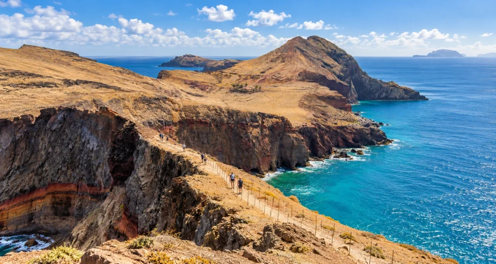
Madeira’s easternmost point and a total contrast to the green island: no trees here — just ochre, basalt and emerald water. Cape São Lourenço is a nature reserve crossed by the PR8 hiking trail: 3 km each way along a ridge with views of the ocean on both sides. The full hike takes 2.5–3 hours, but even the first 40 minutes to the viewpoints deliver “that” view.
- Important: the cape is almost always windy and has no shade — windbreaker, sunscreen and water are essential
- Parking: free at the trailhead; in summer arrive before 10:00
13:00 — Machico or Santa Cruz: The Final Lunch
On the way back to the airport, stop in Santa Cruz — a pretty seaside town 5 minutes from the terminal. Waterfront restaurants, views of taking-off planes (the runway stands on stilts above the ocean — a show in itself), a calm finale to the trip.
15:00 — Airport: Car Drop-Off
Refuel (there’s a petrol station 2 km from the terminal), return the car — and fly out. Allow 30–40 minutes for the drop-off: in high season there are queues at the rental desks.
What to Taste Along the Route: Food Stops
Madeira is an island where food is an attraction in itself, and our route passes the main “tasty” spots.
- Espada (black scabbardfish). A deep-water fish with tender white meat, the island’s signature fish dish. Don’t confuse it with swordfish — in Portuguese that’s espadarte. The classic serving is with banana and passion fruit. Best tried in Câmara de Lobos (day 1), where the catch is unloaded right onto the quay.
- Espetada on a bay skewer. Beef in large chunks threaded on a branch of bay laurel — the signature dish of the mountain areas. Look for it in Santana (day 2): the meat arrives hanging from a metal stand straight to your table.
- Bolo do caco. A small sweet-potato flatbread toasted with garlic butter — served instead of bread everywhere. Dangerously tasty.
- Poncha. The island’s official drink: sugarcane aguardente, honey and lemon or passion-fruit juice. Stronger than it seems. For the driver — the alcohol-free version or a tasting in the evening after parking.
- Madeira wine. Fortified wine that was “cooked” in ship holds back in the 16th century. Dry Sercial as an aperitif, sweet Malvasia with dessert. In Funchal there’s the tasting room of the old Blandy’s house, while the Henriques & Henriques cellars are in Câmara de Lobos — right on the day 1 route.
- Mini-bananas and passion fruit. Local bananas are small, sweet, slightly tart — don’t confuse them with imports. You can see plantations all along the old ER101 on day one; the easiest places to buy are the Lavradores market in Funchal or any island supermarket.
What to Pack for the Road
The route crosses several climate zones every day, so pack for “the seaside and the mountains” at once:
- Layers: T-shirt + fleece + windbreaker. It can be +25 °C on the coast and +8 °C with wind on Arieiro an hour later.
- Hiking shoes with non-slip soles — for the Balcões levada and Cape São Lourenço (rocky trails, slippery after rain).
- SPF50 sunscreen — the sun at altitude is aggressive even in cloud.
- Water and snacks in the car — cafés are rare on mountain stretches.
- Small cash — for parking and farm stalls (cards are accepted almost everywhere, but not at markets).
- Power bank — weather webcams, navigation and photos drain the battery fast.
Practicalities: Car Rental, Budget, Costs
Rental tips:
| What | Recommendation |
|---|---|
| Class | compact or mid-size (Golf, Megane): reserve power matters more than savings |
| Engine | from 1.2 turbo or 1.6 naturally aspirated if travelling three- or four-up with luggage |
| Gearbox | automatic is easier at uphill traffic lights; manual is cheaper |
| Ground clearance | standard is fine, no SUV needed — tarmac all along the route |
| Insurance | full cover with zero excess: parking is tight, scratches are common (+€8–15/day) |
| Deposit | €100–300 with full insurance; without it they block €1,200–1,500 on your credit card |
| Where to rent | FNC airport with terminal pick-up: the route starts and ends there |
Trip budget (transport and sights), approximate:
| Item | Amount |
|---|---|
| Compact rental, 3 days | €75–105 low season · €135–180 in summer |
| Fuel, ~18–20 l (petrol 95) | €30–40 |
| PR levadas, 2 people × 2 trails | €12 |
| Parking for the trip | ~€10 |
| Total | ~€130–240 |
There are no toll roads on the island. Cabo Girão, all viewpoints, the Anjos waterfall and Cape São Lourenço are free. Levada entry is paid online via the SIMplifica platform (since 2025 — €3 per non-resident per trail).
Driving Tips for Madeira
- Don’t fear the tunnels — there are over a hundred, all well lit. But there are speed cameras inside.
- Old roads = give way. On narrow stretches the rule is: whoever can pull over more easily yields. Buses and locals know every centimetre — don’t compete with them.
- Parking on a slope: handbrake + gear (on an automatic — P and a brick under the wheel if the slope is serious). That’s what locals do.
- Fill up in towns. There are no petrol stations in the mountains, and consumption on climbs is noticeably higher.
- Webcams before heading into the mountains. If Arieiro is “milk”, reshuffle the day: go west and move the peak to another morning. Madeira’s weather changes every couple of hours.
- Navigation: Google Maps works great, but boldly multiply mountain driving times by 1.5.
When to Go and Where to Stay
Season. Madeira is the island of eternal spring: +17…+20 °C in winter, +24…+27 °C in summer.
| Season | What it’s like |
|---|---|
| April–June | optimum: the bloom after which the island is called a “floating garden”, +20…+24 °C, clearer summits more often |
| July–August | warmest sea, but queues at Cabo Girão and the São Lourenço car park; leave earlier for sunrise |
| September–October | second optimum: the ocean at its warmest, noticeably fewer tourists |
| November–March | +17…+20 °C, rain more often in the north, but the south and the summits almost always save the day; the lowest car-rental prices |
Base. For a three-day route it’s best to stay in Funchal all three nights: every day starts and ends within an hour of the capital, evenings mean restaurants and the promenade, and there’s no packing and moving. For a change, the third night can be spent in Machico or Santa Cruz near the airport.
Common Questions About a Madeira Road Trip
Are 3 days enough for Madeira?
For the “classics” — yes: you’ll see both sides of the island, the mountains, the levadas and the main viewpoints. But the west (Porto Moniz with its lava pools, the Fanal forest, the Véu da Noiva waterfall) doesn’t fit this route — it needs another 1–2 days.
Do I need an International Driving Permit?
No — a national licence from your home country is enough. Rental companies on Madeira accept standard EU-format licences without an IDP.
Is driving in Madeira scary?
No, if you have basic experience on mountain roads. The expressways are European standard, the old roads demand attention, but traffic on them is light. The main thing is not to hurry and to use the lay-bys to let oncoming traffic pass.
Can you do this route without a rental car?
Partly: buses run to Santana and Câmara de Lobos, tours go to Arieiro. But the Anjos waterfall, Encumeada, the summit sunrise and flexible timing — only by car.
What if it rains for three days straight?
That doesn’t happen: Madeira has 5–6 weather zones at once. The rule is simple — watch the webcams and drive where the sun is. Most often it’s the south and the summits.
This route is made for travellers who rent a car for their whole trip. You can book a car with Funchal airport pick-up and full insurance on Carenzzo.com — we compare offers from local rental companies and international brands, with no hidden fees.